Abstract: Inland water transport, along with other modes of transport, experienced significant impacts from COVID-19 and the measures implemented to reduce the spread of the virus and its consequences. The years 2020 and 2021 particularly witnessed notable effects on the performance of inland water transport (cargo, also passenger transport). However, in 2022, the sector faced additional challenges due to the military conflict between Ukraine and the Russian Federation that started at the end of February. This conflict further disrupted the performance of inland water transport.
It is anticipated that the recovery of the sector will be gradual, and it may take several years to fully regain the pre-2020 levels of performance. The effects of the pandemic and the ongoing conflict in Ukraine have created long-lasting repercussions, requiring time for the industry to recover and reach previous performance levels.
THE IMPACT OF COVID 19 ON CARGO TRANSPORT BY INLAND WATER TRANSPORT IN EUROPE DURING THE PANDEMIC YEARS
Abstrakt: Vnútrozemská vodná doprava spolu s ostatnými druhmi dopravy zaznamenala významné dopady COVID-19 a opatrení prijatých na obmedzenie šírenia vírusu a jeho následkov. Najmä roky 2020 a 2021 boli svedkami výrazného vplyvu na výkonnosť vnútrozemskej vodnej dopravy (nákladnej, ale aj osobnej). V roku 2022 však tento sektor čelil ďalším výzvam v dôsledku vojenského konfliktu medzi Ukrajinou a Ruskou federáciou, ktorý sa začal koncom februára. Tento konflikt ešte viac narušil výkon vnútrozemskej vodnej dopravy.
Očakáva sa, že oživenie sektora bude postupné a môže trvať niekoľko rokov, kým sa úplne obnoví na úroveň výkonnosti spred roku 2020. Účinky pandémie a pokračujúceho konfliktu na Ukrajine vyvolali dlhotrvajúce následky, ktoré si vyžadujú čas, aby sa sektor vnútrozemskej vodnej dopravy zotavil a dosiahol predchádzajúce úrovne výkonnosti.
Keywords: COVID-19, measures, inland water transport, cargo transport,
JEL: L91
1 Generally, inland water transport
Water transport plays an important role in the transport system of the states in the transport of goods for which the speed of transport is not decisive. It is irreplaceable in the transport of shipments with a large weight or dimensions, it ensures a direct connection through rivers, lakes, or canals between sea and inland ports.
The status of water transport is conditioned by historical development and geographical, or economic conditions. For it to function properly, it is necessary for the country to have a sufficiently dense river network (naturally navigable rivers, canals, or lakes) flowing through industrial and commercial centres. South American countries, or Africa has a relatively dense network of waterways, but its current political and economic development does not support the development of this type of transport. The use of waterways is only partial, if not minimal. On the other hand, the countries of Western Europe, North America, and Southeast Asia use water transport to a large extent in the transport of bulk, piece, and liquid consignments, including intermodal cargo units by means of motor cargo ships, or pressure assemblies. Not only canals, lakes, and naturally navigable rivers are used for transportation, but also rivers with a greater slope, while various devices such as locks, and lifts are used to overcome height differences.
For the sake of safety and smooth operation on the waterway, European waterways are divided into classes due to which each class defines the maximum permissible dimensions of a motor cargo ship or a pushed convoy. It is essential that any river that is used for the transportation of cargo has sufficient flow or depth throughout the year. The navigability of rivers is ensured in three ways, i.e., regular maintenance, regulatory adjustments, or by dams or dykes.
The operation of the waterway is affected by various operational failures or irregularities that affect its transport capacity and reliability. Compared to other roads, waterways are more dependent on natural influences (development of the hydrological situation – low or high-water level, ice phenomena). Accidents or repairs of objects located on the waterway are much more serious than for other modes of transport due to the lack of a dense navigation network.
2 European inland waterways
The European continent has 29 thousand kilometres of waterways, of which 14 thousand km are waterways of international importance (class IV to VII according to the European Agreement on Main Inland Waterways of International Importance (AGN)).
The European network of waterways (Fig. 1) can be divided into two categories:
- a unified network of European shipping network, which includes the countries of Western, Central, and Eastern Europe, including Ukraine and the European part of the Russian Federation,
- isolated parts of the European shipping network, which include the shipping network of Great Britain and Ireland, Scandinavia (Norway, Sweden, Finland), northern Italy, and the Iberian Peninsula (Spain, Portugal). [1], [2], [3], [4]
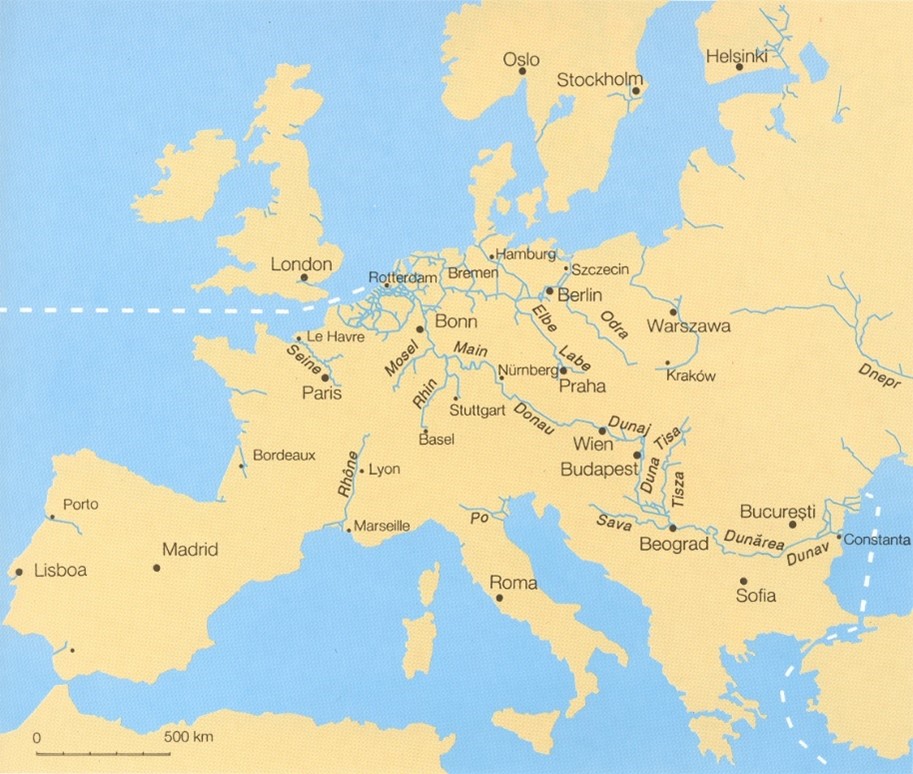
source: [1] (image editing: authors)
Fig. 1. European waterways
2.1 Waterway Rhine – Main – Danube
After the opening of the Main-Danube Canal in 1992, the Danube was linked with the waterways of Western Europe (the Rhine and its tributaries). A new waterway Rhine-Main-Danube which is about 3 500 km long connects the North and Black Sea. [1], [2], [3], [4]
2.1.1 The Rhine
Although the Rhine does not belong to the longest European rivers, it is the busiest European waterway. It flows through the countries of Western Europe (Switzerland, France, Germany, and the Netherlands) and flows into the North Sea in the Netherlands.
The Rhine originates in the Swiss Alps and in its upper course it is the border river of Switzerland with Austria, after flowing through Lake Constance and with Germany. From the Swiss city of Basel – the highest Rhine port – it is a canalized and energetically used French-German border stream. After further flowing through Germany and the Netherlands, it empties into the North Sea together with the French-Belgian-Dutch river Maas. Together with the navigable right-hand tributaries of the Neckar, Main, and the Lahn and the left-hand tributary of the Mosel (Moselle), as well as the subsequent branches to the canals in the north of Germany, it is the main waterway of Western Europe with an annual volume of cargo transportation exceeding a few millions of tons of goods. According to AGN the Rhine waterway is part of the most important Western European diametrical E10 – the route connecting the North and Mediterranean Seas via the Rhine-Rhône Canal and the French rivers Saone and Rhône. [1], [2], [3], [4]
2.1.2 The Main
Near the city of Mainz, the most important right-hand tributary, the Main, flows into the Rhine. This river with 34 energy-navigable dams originates in the mountains near the German-Czech border and is navigable in a length of about 340 km from Bamberg, where the Main-Donau Canal connecting the Main via Nuremberg and the continent’s watershed with the Danube begins in the course of its left-hand tributary Regnitz. The volume of ship transport is about thousands of tons per year, the Main is among the most powerful and, due to its position in the network of European waterways, also among the most important European shipping routes, as it connects the Rhine through the canal with the Danube basin. It is therefore also part of one of the two main continental transversals (AGN E80 routes). Also, according to the European agreement TEN-T on the trans-European network of multimodal transport highways, it is part of the seventh, so-called water corridor between the North and Black Seas. [1], [2], [3], [4]
2.1.3 The Main – Danube Canal
The construction of the Main-Danube Canal began in 1960 when the construction of its northern part from the city of Bamberg to the city of Nuremberg began. It was completed in 1992 when it was also opened for commercial shipping. The canal connected the North and Black Seas, and a total drop of 815 m is overcome when sailing from the North to the Black Sea. The total length is 171 km, and it has 16 locks. There, we find the highest lock in Europe, which is located on the Hilpoltstein dam at a height of 406 meters above sea level. The main port on the canal is the port of Nuremberg. Locks have a depth of 4 m and useful dimensions of 190 x 12 meters. The canal corresponds to class Vb with a draft of 250 cm. Some locks are equipped with re-utilization basins to reduce the total amount of water required for vessels to pass through. The amount of savings depends on the number of basins. Water for the operation of the locks is taken from a tributary of the Danube – the river Altmühl and is pumped using the cheaper night flow to the top reservoir, from where it flows back due to the passage of ships in the locks. The Dürrlöh side reservoir is connected to the peak reservoir, which enables equalization of the difference between the amount of water pumped and the amount of water used for crossing vessels per day, or in a week. [1], [2], [3], [4]
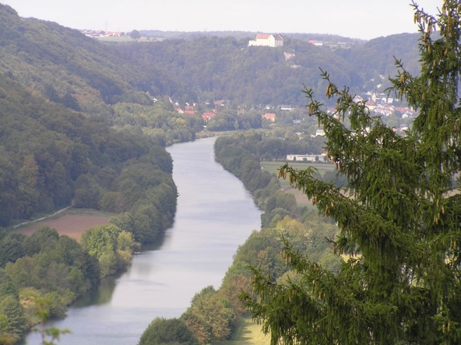
source: authors
Fig. 2. The Main-Danube Canal
2.1.4 The Danube
The Danube is the second-longest European river after the Volga which flows through 10 countries of Central and Eastern Europe. Commercial navigation is carried out from the German city of Kelheim (km 2,414.72). The Danube flows through ten European countries (Germany, Austria, Slovakia, Hungary, Croatia, Serbia, Romania, Bulgaria, Moldova, and Ukraine) and four capital cities (Vienna, Bratislava, Budapest, and Belgrade). With this number, it can be included among the waterways that flow with the largest number of countries. The four Danubian countries are located on only one bank of the Danube (Croatia – right bank, Bulgaria – right bank, Moldova – left bank, and Ukraine – left bank). Shortly before the mouth of the Black Sea, it forms the so-called Danube Delta, which consists of three branches. The middle arm (Sulina) is used for commercial shipping.
From the transverse profile, the Danube is divided into three sections. The 624-kilometer-long Upper Danube has the character of a mountain river and flows through Germany, Austria, Slovakia, and Hungary (in the end it creates a natural state border between Slovakia and Hungary). It starts in the German city of Kelheim (km 2,414.72), where the Main – Danube Canal stars and ends in Hungarian Gonya (km 1,791.33). On this section, it falls about 37 centimetres per kilometre. Sixteen of the eighteen energy-navigability dams are located there. Most of them lie on the territory of Austria, the rest on the territory of Germany, one waterworks is in Slovakia. The four stages lying in Germany have one lock. The biggest dam on this section of the Danube is the Gabčíkovo waterworks. Vessels reach a speed of 16 to 18 kilometres per hour downstream, 9 to 13 kilometres per hour upstream.
In the middle and lower part, the Danube already has the character of a lowland river. The Middle Danube is 860 kilometers long, it starts in Gonyu (km 1,791.33) and ends in the Romanian city of Drobeta Turnu Severin (km 931.00). In this part, it flows as a border river between Slovakia and Hungary, then flows through Hungary, then creates a natural state border between Croatia and Serbia, then flows through Serbia and enters Romania as a border river between the two countries. In this section, the Danube drops by 8 centimetres per kilometre.
source: authors
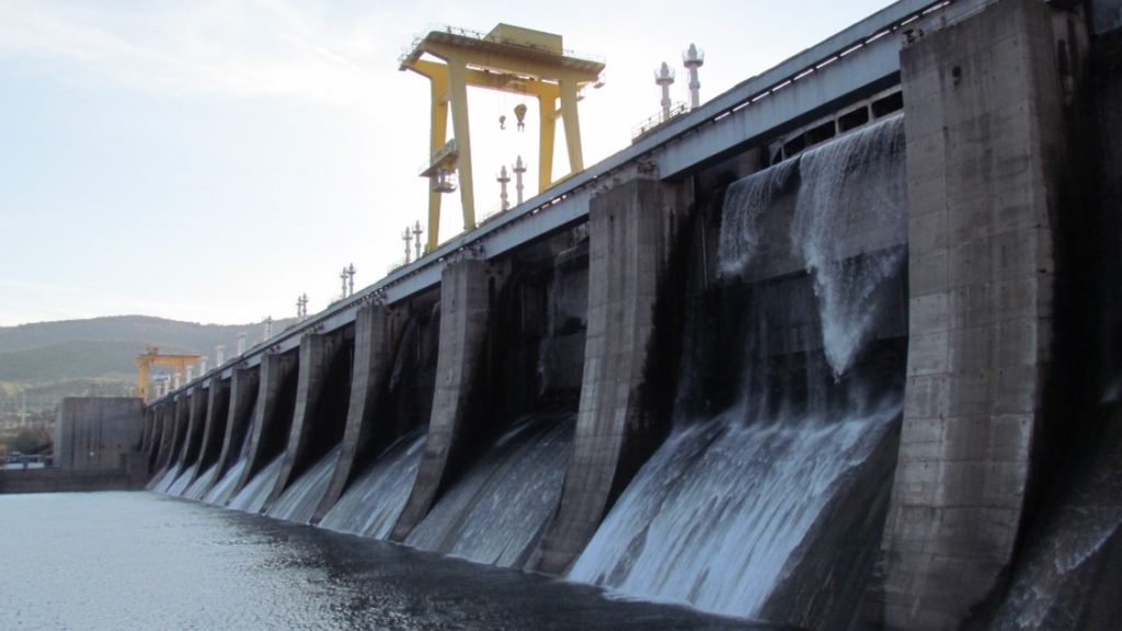
Fig. 3. The Iron Gates I.
Above the Romanian town of Drobeta Turnu Severin there is the largest waterworks on the Danube (Iron Gate I.). This waterworks was built based on cooperation between the former Yugoslavia and Romania in order to use electricity and improve navigation conditions in the Kazan Valley, through which the Danube flows. The speed of vessels downstream is 18 to 20 kilometres per hour, upstream 9 to 13 kilometres per hour.
The Lower Danube, 931 kilometres long, is the longest section. In this part, the Danube forms a natural state border between Romania and Serbia, then between Romania and Bulgaria, from AD 374 it flows through the territory of Romania, and finally forms a state border between Romania and Moldova, then between Romania and Ukraine. In this section, the Danube drops about 4 centimetres per kilometre. The only stage on the Danube is located here – the Iron Gate II waterworks. Downstream the vessels reach a speed of 18 to 20 kilometres per hour, upstream 11 to 15 kilometres per hour. [1], [2], [3], [4]
3 Cargo transport on the Rhine and its tributaries during pandemic years
Cargo transport on the traditional Rhine route, stretching from Basel to the German-Dutch border, reached a total of 168.6 million tonnes in 2021. This marked a 5.4% increase compared to the 160.0 million tonnes transported in 2020. However, despite the growth, the 2021 figure remained 3.2% lower than the cargo transport volume recorded in 2019. These numbers reflect the ongoing recovery process from the Covid-19 pandemic. In terms of transport performance, the value in 2021 was 6.4% lower than that of 2019, but it did show a 4.5% improvement over the previous year, 2020.
In addition to the comprehensive cargo transport on the traditional Rhine route, specific measurement points such as locks or border points are used to register cargo transport and vessel movements. The volumes recorded at these points reflect the transport activity exclusively at those locations and do not encompass the entirety of Rhine transport. Nonetheless, this methodology allows for the identification of variations in transport intensity across various stretches of the Rhine, highlighting distinctions between the Lower and Upper Rhine, for instance.
The West German Canal network, consisting of the Wesel-Datteln Canal and the Rhine-Herne Canal, serves as a vital conduit for the transportation of liquid cargo and coal. The logistics of the chemical industry along the Wesel-Datteln Canal heavily rely on this waterway, as do the energy sector, particularly coal-fired power plants. In 2021, there was a notable increase of 12% in goods transport on the Wesel-Datteln Canal and a 3% increase on the Rhine-Herne Canal.
The river Main predominantly caters to the construction sector, with materials such as sands, stones, and building materials comprising 30% of its transport volume in 2021. However, there was a 10% decrease in transport volumes on this eastern tributary of the Rhine in the same year.
The river Moselle plays a significant role in transporting iron ore, coal, and agribulk due to the steel production in the Saar region of Germany and the agricultural production in the Lorraine region of France. In 2021, the lock of Koblenz witnessed a substantial increase in the transport of iron ore (+46%) and coal (+42%), mirroring similar trends observed on the Rhine. However, the transport of agribulk experienced a decline (-8%). Overall, there was a 13% increase in goods transport at the lock of Koblenz, where the Moselle meets the Rhine, and a 15% increase at the lock of Apach, located at the German-French border.
While container transport on the Moselle had been steadily growing over the past decade, the trend slightly weakened in 2021. A total of 24,438 twenty-foot equivalent units (TEU) were recorded at the lock of Koblenz, compared to 25,521 TEU in 2020. It is worth noting, however, that container transport was approximately 30% lower just six years earlier in 2015, with only 16,896 TEU transported on the Moselle. [5]
3.1 Rhine transport by cargo segment
While previous annual reports and data from 2013 to 2020 indicated a gradual decline in coal transport on the Rhine, the year 2021 witnessed a notable reversal of this trend, with coal transport increasing by 28.5%. This significant rise can be attributed to the high demand for coal in the energy sector, driven by elevated gas prices, as well as increased steel production. Since March 2022, the demand for steam coal, primarily used in the energy sector, has further surged due to escalating gas prices resulting from the conflict in Ukraine. A clear example of the interconnectedness between seaborne trade and inland waterway transport can be observed in the Port of Amsterdam, where seaborne handling of coal surged by 41% in 2021, reaching 10.4 million tonnes. The port attributes this development to the considerable increase in gas prices.
On the other hand, iron ore and metals have shown signs of recovery compared to 2020 and the impact of the Covid-19 pandemic. Container transport, agribulk, and food products, sand, stones, gravel, as well as mineral oil products and chemicals, have remained relatively stable. Mineral oil products, however, have faced challenging conditions due to the pandemic and the subsequent reduction in mobility and demand for gasoline, diesel, and kerosene. [5]
3.2 Transport of containers on the Rhine
Container transport on the traditional Rhine recorded a total of 1.99 million twenty-foot equivalent units (TEU) in 2021, representing a slight increase of 0.9% compared to 2020. However, when compared to the pre-Covid year of 2019, the volume remained 2.8% lower. A closer examination of the data from 2014 to 2017, in contrast to the period from 2018 to 2021, reveals that TEU volumes in the more recent years settled at a lower average level. This can be attributed to several factors:
- Until 2017, world trade and exports of goods from Europe to overseas experienced growth, but in 2018 and 2019, they stagnated before sharply declining in 2020 due to the impact of the pandemic.
- The low water conditions experienced in 2018 resulted in cargo losses and prompted a shift from Rhine transport to railway transport.
- Inland container barging also faced challenges due to congestion in seaports, leading to related delays that affected the overall efficiency of transport operations.
The downstream direction (from south to north) of container transport on the Rhine exhibits a greater proportion of containers loaded with cargo compared to the upstream direction. This disparity reflects the pattern of exporting goods from the Rhine hinterland, encompassing regions in France, Germany, and Switzerland, towards seaports in the ARA (Antwerp, Rotterdam, Amsterdam) area of Belgium and the Netherlands, which serve as gateways to global markets overseas. In contrast, containers transported upstream are more frequently empty. This is because empty containers need to be returned to the hinterland to be refilled with goods destined for export.
When comparing the years 2017, 2019, 2020, and 2021, it becomes evident that the export of goods through the Rhine has declined, as indicated by the decrease in the number of loaded containers. In 2017, the figure stood at 1.010 million twenty-foot equivalent units (TEU) (represented by the “Downstream/Loaded” bar), but by 2021, it had dropped to 0.897 million TEU. Several factors contribute to this downward trend, including the impact of low water conditions experienced in 2018, a general slowdown in the economy, and a shift away from using the Rhine for transport in favour of rail alternatives. [5]
4 Cargo transport on the Danube and its tributaries during pandemic years
Cargo transport along the entire navigable Danube, spanning from Kelheim in Germany to the Black Sea through the Danube-Black Sea Canal and the Sulina Canal, typically ranges between 36 and 40 million tonnes annually. In terms of transport performance, which encompasses the EU Danube countries and Serbia, the Danube recorded 29.8 billion tonne-kilometres (TKM) in 2021, remaining at the same level as in 2020.
On the Danube, especially on the Lower and Middle Danube, a significant portion of goods transport is carried out through pushed convoys. At the measurement point of Mohács on the Middle Danube, pushed convoys accounted for 78.0% of all cargo transport in 2021, compared to 75.7% in 2020, 79.5% in 2019, and 78.7% in 2018.
The lower section of the Danube, particularly in the Danube delta region known as the “maritime Danube,” benefits from higher water depths, resulting in increased cargo transport compared to upstream river sections. This is particularly evident in the Danube-Black Sea Canal, which stretches from Cernavodă on the Danube River to Constanţa and Năvodari on the Black Sea. In 2021, the canal witnessed a transport volume of 17.3 million tonnes, representing a 4.7% increase compared to 2020. Another important estuary arm is the Sulina Canal, which flows into the Black Sea near the Romanian-Ukrainian border in the Danube delta region. [5]
4.1 Danube transport by cargo segment
In 2021, iron ores represented the largest volume of cargo transported on the Middle Danube, surpassing agribulk. Steel production in the Danube region experienced a recovery from the impacts of the Covid pandemic in 2020. However, the transport volume of iron ore in 2021 did not reach the levels observed in 2019. This can be attributed to a low water situation that occurred in the last quarter of 2021, which likely affected the transportation of iron ore along the Danube.
The agricultural segment holds the second position in terms of cargo transported on the Danube, trailing behind iron ore. The demand for agricultural transport exhibits volatility, primarily driven by fluctuations in harvest volumes from year to year, as well as competition between different harvesting regions such as the Middle Danube region and the Black Sea region. This competition is often influenced by price differentials.
During the third quarter of 2021, the Black Sea region experienced an increase in market shares for grain exports to North Africa and other parts of the world, which had a negative impact on the transport volume of grain along the Danube between the Middle Danube region and the seaport of Constanţa. However, it is worth noting that the situation is expected to change in 2022 due to the ongoing war in Ukraine.
On the Upper and Middle Danube, iron ore is predominantly transported upstream, while grain, food products, and foodstuffs are primarily transported downstream. This reflects the supply of raw materials to the steel industry in Austria, Hungary, and Serbia, as well as the export of agricultural products from Hungary and Serbia downstream to seaports, particularly Constanta. [5]
4.2 Transport of containers on the Danube
Hungary and Austria are currently the two Danube countries with the highest container transport. In 2021, 7,297 TEU were transported on Hungarian inland waterways, which represents the second-highest value between 2007 and 2021. In Austria, container transport amounted to 5,226 TEU in 2021, showing an increase compared to the years 2018, 2019, and 2020.
When considering the weight of cargo, container transport on Hungarian waterways accounted for 14 thousand tonnes in 2021, while in Austria, 9 thousand tonnes of cargo were transported in containers. These figures highlight the significant difference between the two countries and other Rhine countries.
In the Netherlands, 53.1 million tonnes of cargo were transported in containers on inland waterways in 2021, followed by 22.4 million tonnes in Belgium, 20.9 million tonnes in Germany, and 3.3 million tonnes in France.
In Romania, container transport reached 1,714 TEU in 2021. Over the past 15 years, there has been no significant upward trend, and since a notable decline in 2013, the level of container transport has remained relatively low. [5]
5 Conclusion
Inland water transport, as other modes of transport, was also affected by COVID-19 and the measures that were taken because of the reduction of ill persons, and their victims. While the impact of the measures, which were taken in 2020 and 2021, was more significant, in 2022 the performance of inland water transport was affected by the military conflict in Ukraine that started at the end of February. It will take a few years while this sector will fully recover, and the performance of this mode of transport will reach the same numbers as they were before 2020.
6 References
- DÁVID, A.: Vodné cesty. EDIS – vydavateľské centrum ŽU. 119 s., ISBN 978-80-5541613-7.
- KUBEC, J. – PODZIMEK, J.: Svět vodních cest. NADAS, Praha 1988, 240 s.
- KUBEC, J.: Vodní cesty a přístavy. Skriptum VŠDS/ETMAS, Praha 1993, 232 s.
- KUBEC, J. – PODZIMEK, J.: Vodní cesty světa. Aventinum, Praha 1997, 492 s
- Annual Report 2022, Inland Navigation in Europe, Market Observation, CCNR 2022, 147 s., ISSN 2070—6715, 147 s.
Acknowledgment
This publication was created thanks to support under the Operational Program Integrated Infrastructure for the project: Identification and possibilities of implementation of new technological measures in transport to achieve safe mobility during a pandemic caused by COVID-19 (ITMS code: 313011AUX5), co-financed by the European Regional Development Fund.
Authors:
Andrej DÁVID 1, Andrea MATERNOVÁ2, Vladislav ZITRICKÝ 3
Titles and place of work of the authors:
1Assoc. Prof. Andrej Dávid, PhD., Department of Water Transport, University of Zilina, Univerzitna 8215/1, 010 26 Žilina, E-mail: andrej.david@uniza.sk
2 Ing. Andrea Maternová, PhD., Department of Water Transport, University of Zilina, Univerzitna 8215/1, 010 26 Žilina, E-mail: andrea.amernova@uniza.sk
3Assoc. Prof. Vladislav Zitrický, PhD., Department of Railway Transport, University of Zilina, Univerzitna 8215/1, 010 26 Žilina, E-mail: vladislav.zitricky@uniza.sk
